
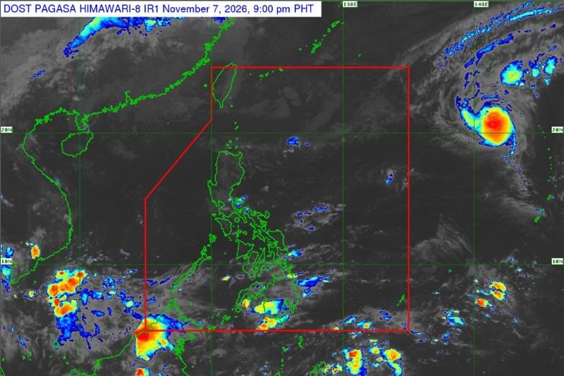
A new tropical storm has developed outside the Philippine Area of Responsibility (PAR), according to the Philippine Atmospheric, Geophysical and Astronomical Services Administration (PAGASA). The storm was classified as a tropical depression around 8:00 AM on Saturday.
The storm was located approximately 2,400 kilometers east of Extreme Northern Luzon, packing winds of up to 65 kilometers per hour and gusts reaching 80 kilometers per hour. It is moving in a west-northwest direction at a speed of 30 kilometers per hour.
PAGASA has indicated that the storm is not expected to have any direct impact on the Philippines during the weekend. However, forecasts suggest that it may enter the PAR by Monday or Tuesday.
Frequently Asked Questions
Where is the new tropical storm located?
The storm is situated about 2,400 kilometers east of Extreme Northern Luzon.
What are the wind speeds associated with the tropical storm?
The storm has winds of 65 kilometers per hour and gusts of up to 80 kilometers per hour.
When is the storm expected to enter the Philippine Area of Responsibility?
The storm is projected to enter the PAR on Monday or Tuesday.
Reporting by Gerald Queen for Rapport Philippines. This report was prepared from available source material and reviewed for factual consistency. Further verified updates will be added as the newsroom receives them.